BanD-AID
Bringing together several research disciplines to study the Bangladesh delta
The Bangladesh delta is home to over 150 million people and located at the confluence of the Ganges, Brahmaputra and Meghna Rivers. The high population density and flat topography make the delta vulnerable to sea level rise, and storm surges. For example, Cyclone Sidr in 2007 caused over 3400 deaths and an economic loss of about US$ 1.7 billion.
In addition to cyclones, several other factors play a role in Bangladesh. Monsoonal flooding, salt water intrusion, coastal and river bank erosion, and drink water contamination , all affect the livelihoods of the people in Bangladesh.
The collaborative research project Bangladesh Delta: Assessment of the Causes of Sea-level Rise Hazards and Integrated Development of Predictive Modeling Towards Mitigation and Adaptation (BanD-AID) was initiated in 2012, and funded through the Belmont Forum for a 3 year period (funding ends in 2016). It brought together researchers from various disciplines ranging from geodesy to social sciences from the US, Germany, France, Bangladesh and Australia, in an effort to assess sea level change and its implications in the region. The research involved the use of satellite data, installing geodetic receivers and tide gauges, as well the undertaking of questionaires in selected villages.
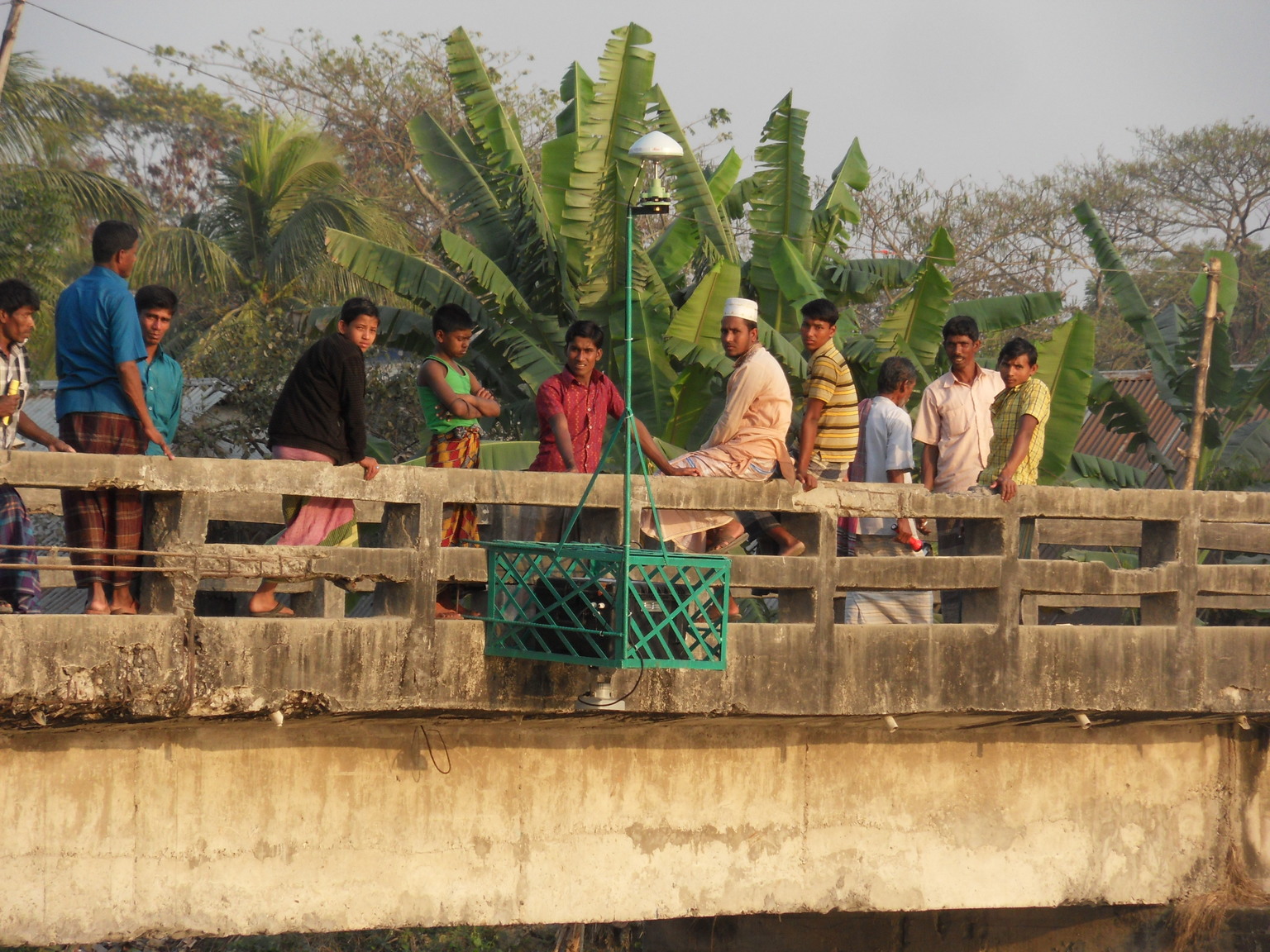
The bridge was the most stable point available to mount a tide gauge equipped with a GPS-receiver
Within this project, the contributions of our working group in Bonn (J. Kusche, B. Uebbing and R. Rietbroek) have covered the use of satellite observations and tide gauges (pdfs of related publications can be downloaded found here and here. For example, we compared a combination of spaceborne radar measurements and time variable gravity fields from the GRACE mission)) with sea level variations at several tide gauges. Fig. 2 illustrates the finding that sea level variations originate mainly from the coastal regions.
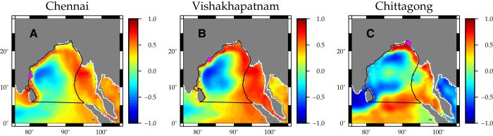
Fig. 2 Sea level variations measured at tide gauges reflect variations along large stretches of the coastal ocean. The figures depict the correlation of the tide gauge data with sea level variations from a combination of radar altimetry and GRACE gravity observations.
More information on the project can be found on the official website.